Bethlehem, PA
Location
Mapping
Study type
Parcel by parcel
Method
Moravian-founded
Historic core
Concept
How a city's founding shapes its form
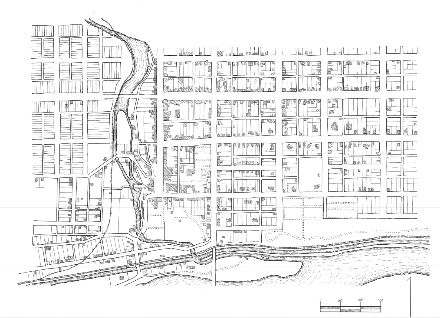
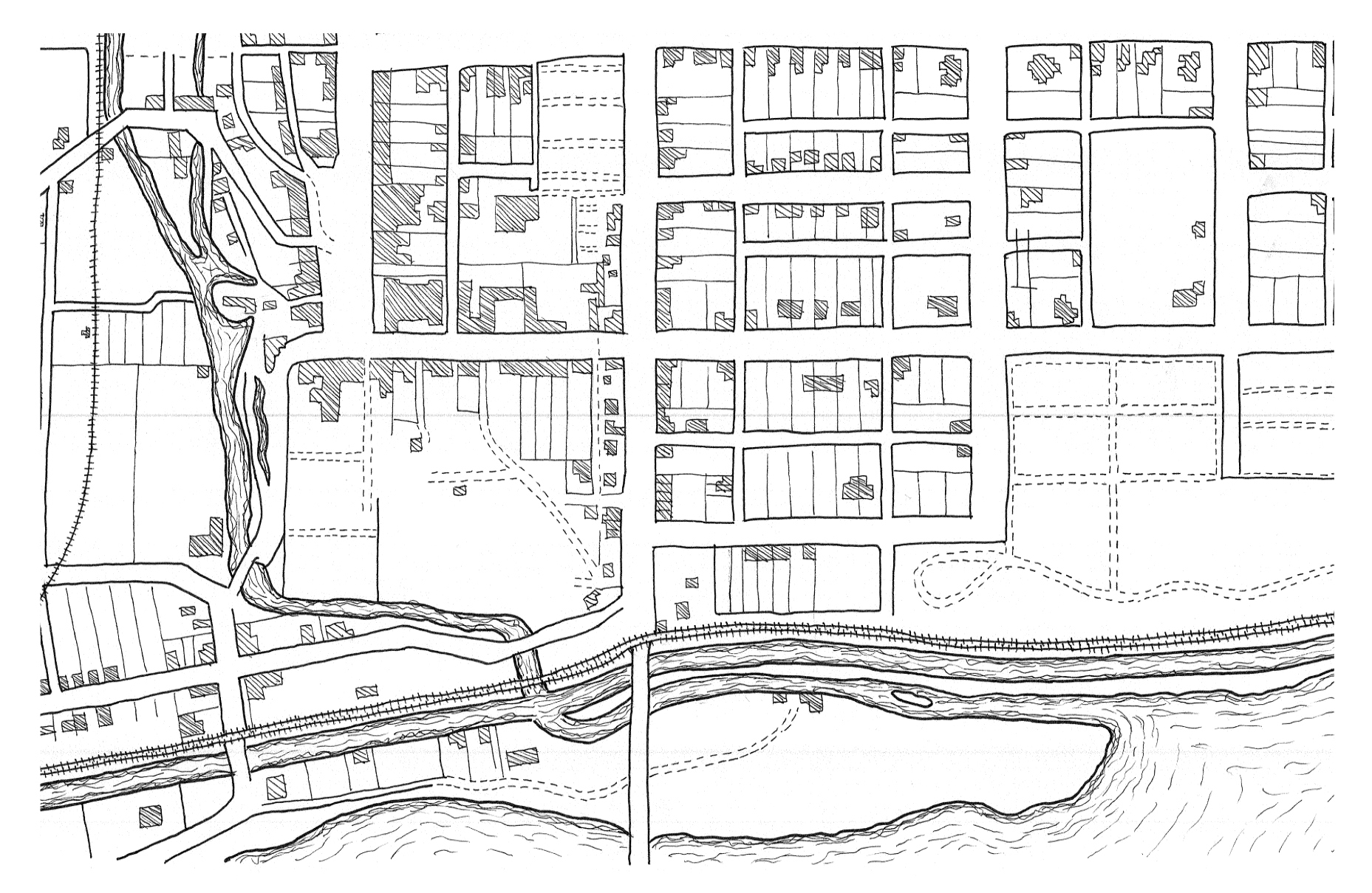
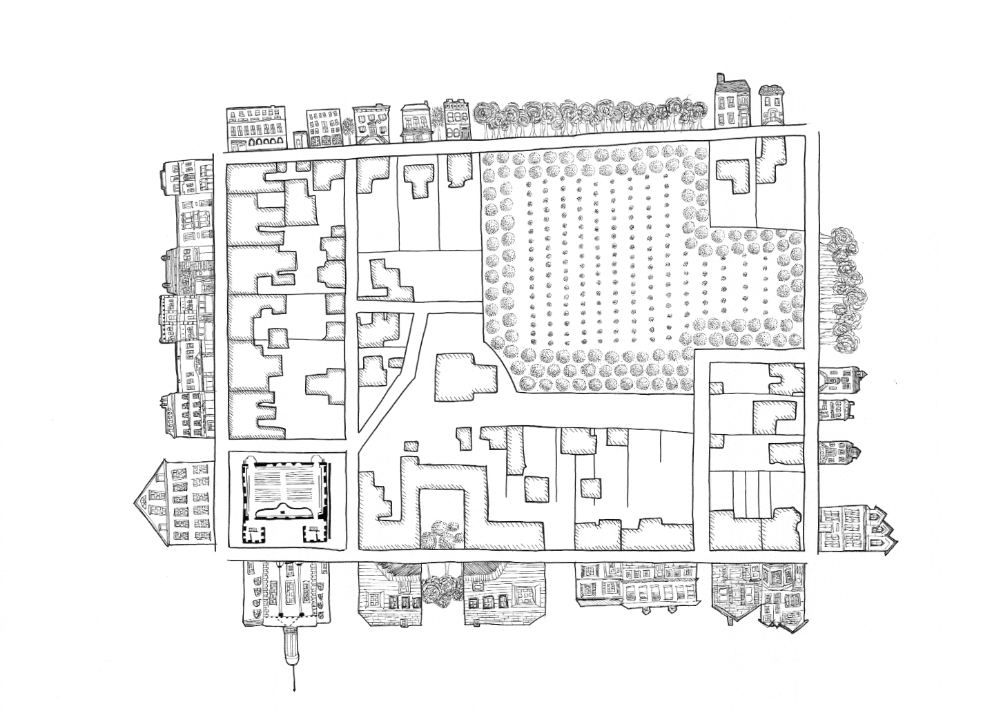
Mapping the layout of Bethlehem, Pennsylvania — from its industrial riverfront to its dense residential blocks and public square — became a study in how a city's founding shapes its long-term form. Traced parcel by parcel, the drawings reveal a rural character distinct from denser urban settings: low-rise blocks, factory grounds along the river and rail line, and a Moravian-founded core whose simplicity in stone and wood still defines the historic district. The exercise uncovers how industry and settlement history, rather than height or density, are what give the city its particular grain and identity.
Drawings
Project documentation